10 Best GIS Courses for 2024: Navigating Spatial Data
Work better with maps and use GIS tools more efficiently with the best GIS online courses available.

In today’s data-driven world, Geographic Information Systems (GIS) play a crucial role in analyzing and interpreting spatial information. GIS is a powerful tool that allows professionals in various fields (environmental science, urban planning, and business) to visualize, interpret, and make informed decisions based on geographical data.
Whether you’re a geographer, urban planner, environmental scientist, or someone interested in leveraging spatial data, acquiring proficiency in GIS can open new opportunities for your career. This Best Courses Guide (BCG) features a curated selection of the best GIS online courses, drawn from over 200 GIS courses in our catalog. These courses, offered by UC Davis, University of Toronto, Esri, LinkedIn Learning, and others, cover a range of topics from GIS fundamentals to advanced spatial analysis techniques.
Click on the shortcuts for more details:
Our Top Picks
| Course Highlight | Workload |
| Best University-Level GIS Specialization for Beginners (UC Davis) | 80 hours |
| Also Great University-Level GIS Specialization for Beginners (University of Toronto) | 52 hours |
| Best Spatial Analysis Course for Beginners (Esri) | 12-18 hours |
| Best ArcGIS, InfraWorks, QGIS and Python Course for Beginners (LinkedIn Learning) | 14 hours |
| Best JavaScript Libraries for GIS Visualization Course (Udemy) | 14 hours |
| Best Geospatial Analysis with Python GeoPandas Course (GeoDelta Labs) | 2-3 hours |
| Best Interactive Python GeoPandas Tutorial (Kaggle) | 4 hours |
| Best R and QGIS Course for Spatial Analysis (Udemy) | 4-5 hours |
| Best GIS Course for Journalists (Knight Center) | NA |
| Project-Based: Openlayers 6 Course (Udemy) | 12 hours |

What is GIS?
Esri, the maker of the powerful GIS software, ArcGIS, defines a geographic information system (GIS) as “a spatial system that creates, manages, analyzes, and maps all types of data”.
A GIS can use any information that includes location, such as data about people, landscape, etc. It helps individuals across various fields compare locations and understand their patterns and relationships by connecting the data to a map
“A geographic information system (GIS) is a computer system for capturing, storing, checking, and displaying data related to positions on Earth’s surface. By relating seemingly unrelated data, GIS can help individuals and organizations better understand spatial patterns and relationships.” – National Geographic.
Why are GIS Skills Important?
National Geographic notes some of the key areas where GIS is used such as by retail businesses to locate a new store, scientists to compare population statistics to resources, federal officials to plan their response to natural disasters, and engineers to develop infrastructure for transport and communication.
Basically, GIS can be used in many different fields to analyze just about any kind of data, so the possibilities are endless. No matter what your area of expertise, you’re most likely to find an application for GIS. Gaining GIS skills is pretty much an extra asset that can set you apart.
BCG Stats
- Combined, these courses have over 213K enrollments.
- 4 courses are free or free-to-audit and 6 courses are paid.
- The most-represented course provider in the ranking is Udemy, with 3 courses.
- The GIS subject is followed by over 31K learners on Class Central.
Best University-Level GIS Specialization for Beginners (UC Davis)
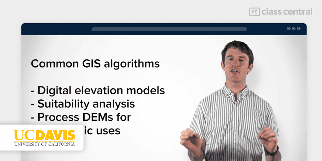
Geographic Information Systems (GIS) is an extensive and beginner-friendly specialization by the University of California, Davis developed in partnership with Esri, the maker of ArcGIS. In these free-to-audit courses, you will learn the necessary skills to successfully use GIS software in your work. Taught by Nick Santos, a GIS specialist, programmer, web developer, and environmentalist.
To access the free-to-audit option, visit each course page linked below. For more information, see A Guide on How to Sign up for Coursera Courses for Free.
The five courses in this specialization are:
- Fundamentals of GIS: Learn the basics of ArcGIS
- GIS Data Formats, Design and Quality: Explore the common data types (raster and vector data, structures, quality and storage).
- Geospatial and Environmental Analysis: Learn the fundamentals of geospatial and environmental analysis through a project.
- Imagery, Automation, and Applications: Become comfortable with spatial analysis and applications within GIS.
- Geospatial Analysis Project: Design and execute a complete GIS-based analysis.
| Institution | University of California, Davis |
| Provider | Coursera |
| Instructor | Nick Santos |
| Level | Beginner |
| Workload | 80 hours |
| Enrollments | 156K (first course) |
| Rating | 4.8/5.0 (5.7K) |
| Certificate | Paid |
Also Great University-Level GIS Specialization for Beginners (University of Toronto)
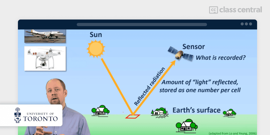
Whether you are new to mapping and GIS or looking to expand your understanding of the subject, GIS, Mapping, and Spatial Analysis, offered by University of Toronto partnered with Esri, will teach you the skills that you can apply to your own work. These free-to-audit courses are taught by Don Boyes who has been learning and using GIS for over 30 years.
Note that you need ArcGIS Desktop installed to follow this course (software not provided).
To access the free-to-audit option, visit each course page linked below. For more information, see A Guide on How to Sign up for Coursera Courses for Free.
The four courses in this specialization are:
- Introduction to GIS Mapping: Learn GIS fundamentals, software navigation, and map creation from real-world data.
- GIS Data Acquisition and Map Design: Explore GIS data basics, metadata, geocoding for non-GIS data, and principles of effective map design.
- Spatial Analysis and Satellite Imagery in a GIS: Master data filtering, vector analysis, and use of remotely sensed and raster data for spatial analysis.
- GIS, Mapping, and Spatial Analysis Capstone: Design your own GIS project.
| Institution | University of Toronto |
| Provider | Coursera |
| Instructor | Don Boyes |
| Level | Beginner |
| Workload | 52 hours |
| Enrollments | 44K |
| Rating | 4.9/5.0 (2K) |
| Certificate | Paid |
Best Spatial Analysis Course for Beginners (Esri)

In Going Places with Spatial Analysis, you will learn spatial data analysis straight from the creators of ArcGIS, Esri. What’s more — you’ll even get free access to the full analytical capabilities of ArcGIS Online, Esri’s cloud-based GIS platform, during the course. Having knowledge of GIS software is helpful but not required to take this course.
Esri is the global market leader in GIS software, location intelligence, and mapping.
- They are the creator of the powerful mapping and analytics software, ArcGIS.
- Esri has supported customers with geographic science and geospatial analytics since 1969.
The six sections in this course are:
- Going Places with Spatial Analysis: Understand the characteristics of spatial data and analysis, and get started with ArcGIS Online.
- Understanding and Comparing Places: Learn the fundamentals of queries, scale of analysis, descriptive statistics, and projection.
- Determining How Places Are Related: Learn about vector overlay, the modifiable areal unit problem, and normalizing data for choropleth mapping.
- Finding the Best Locations and Paths: Explore topology, site suitability, cost paths, and other important concepts.
- Detecting and Quantifying Patterns: Understand density surfaces, spatial autocorrelation, and spatiotemporal analysis.
- Making Predictions: Learn about spatial interaction, regression, surface analysis, and interpolation.
| Institution/Provider | Esri |
| Level | Beginner |
| Workload | 12-18 hours |
| Rating | 4.5/5.0 (18K) |
| Certificate | Free certificate of completion |
Best ArcGIS, InfraWorks, QGIS and Python Course for Beginners (LinkedIn Learning)

Advance Your Skills in GIS is a learning path for beginners that aims to teach you ArcGIS, InfraWorks, QGIS and Python, and core fundamentals of GIS for the architecture, engineering, and construction (AEC) industry. It will be helpful to have these tools installed on your computer.
The five courses in this path are:
- Real-World GIS: Get solutions to real world GIS problems – collecting quality data, creating projections, and finding a GIS job.
- ArcGIS Pro Essential Training: Learn the essentials of working with ArcGIS Pro 2.4, navigating maps and creating new projects.
- Learning QGIS: Work on your GIS data and make more effective maps with QGIS, an open-source GIS software.
- InfraWorks and ArcGIS: AEC Collaboration: Explore how to connect ArcGIS Online to integrate the GIS data into InfraWorks.
- QGIS and Python for AEC: Learn how to use Python scripting to automate and augment the QGIS toolset.
| Provider | LinkedIn Learning |
| Instructor | Jason VanHorn, Gordon Luckett, Lynda Sharkey |
| Level | Beginner |
| Workload | 14 hours |
| Certificate | Paid |
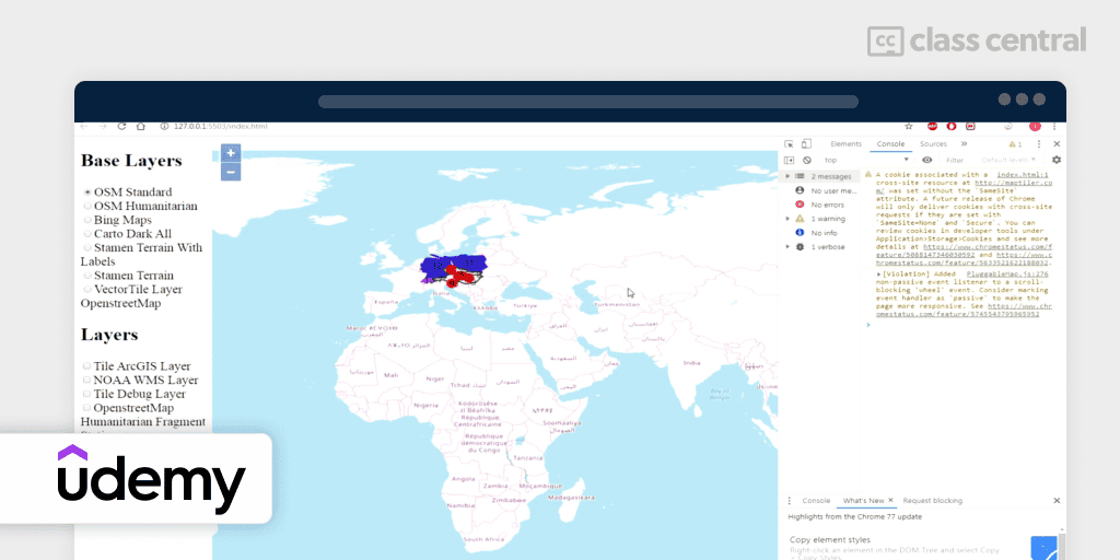
Best JavaScript Libraries for GIS Visualization Course (Udemy)
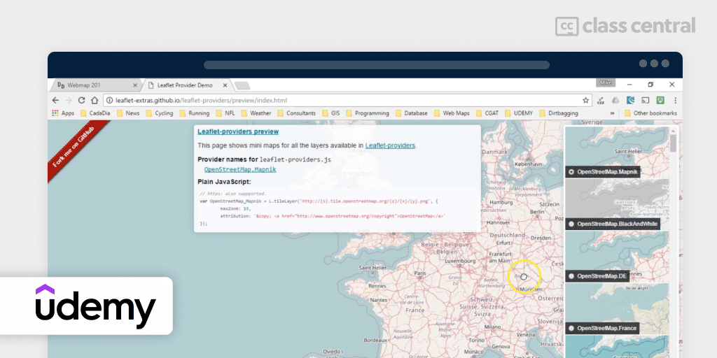
Display and analyze GIS data on the web with Leaflet is an intermediate-level course that teaches you client side mapping applications using the open source javascript libraries, Leaflet.js and Turf.js. By the end of this course you’ll be able to create web interfaces to view, search and analyze your GIS data. All you need is a text editor and an open source web server to get started.
Taught by Michael Miller, a programmer with over 20 years experience in database and geospatial applications, you will learn:
- How to find and zoom to your position on a map
- Use leaflet controls for user interface, geocoding, editing, and loading data
- What background maps are available and how to use them
- How to create vector data and style it in your map, export your GIS data to GeoJSON format and load it into the map
- Filter a subset of your data, search for specific data elements and view their attributes, and analyze spatial relationships.
| Provider | Udemy |
| Instructor | Michael Miller |
| Level | Intermediate |
| Workload | 14 hours |
| Enrollments | 4.6K |
| Rating | 4.7/5.0 (774) |
| Certificate | Paid |
Best Geospatial Analysis with Python GeoPandas Course (GeoDelta Labs)
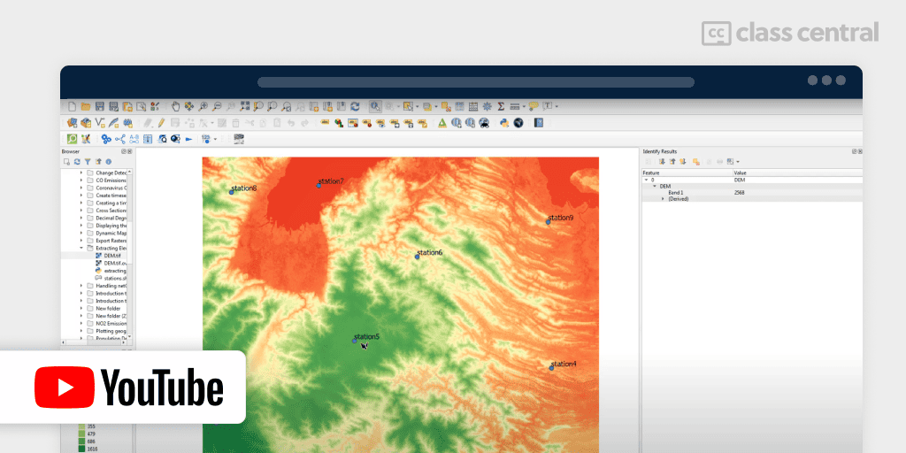
Introduction to Geospatial Analysis with Python GeoPandas is a short free course that will explain all you need to know in order to get started with geospatial analysis. For this course, you’ll be using GeoPandas, an open source project that makes it easier for you to work with geospatial data in Python. However, some familiarity with Python will be helpful in order to take this course.
In this course, you’ll:
- Be introduced to visualizing geospatial data with Python GeoPandas
- Convert coordinates from CSV to ESRI shapefile
- Extract topographic elevations using Python
- Explore ten geoprocessing applications of GeoPandas library.
| Institution | GeoDelta Labs |
| Provider | YouTube |
| Level | Beginner |
| Workload | 2-3 hours |
| Certificate | Not available |
Best Interactive Python GeoPandas Tutorial (Kaggle)
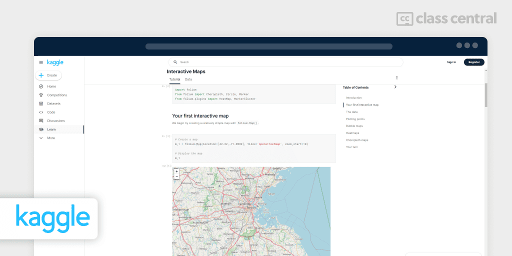
Geospatial Analysis on Kaggle is a free interactive guide where you follow the instructions, read through the explanations, and ultimately, apply your knowledge by writing your own code within the course platform. It is expected that you have previous knowledge of Python to take this course.
In this course, you’ll cover the following topics:
- Coordinate reference systems
- Interactive maps
- Manipulating geospatial data
- Proximity analysis.
| Provider | Kaggle |
| Instructor | Alexis Cook, Jessica Li |
| Level | Intermediate |
| Workload | 4 hours |
| Certificate | Free |
Best R and QGIS Course for Spatial Analysis (Udemy)
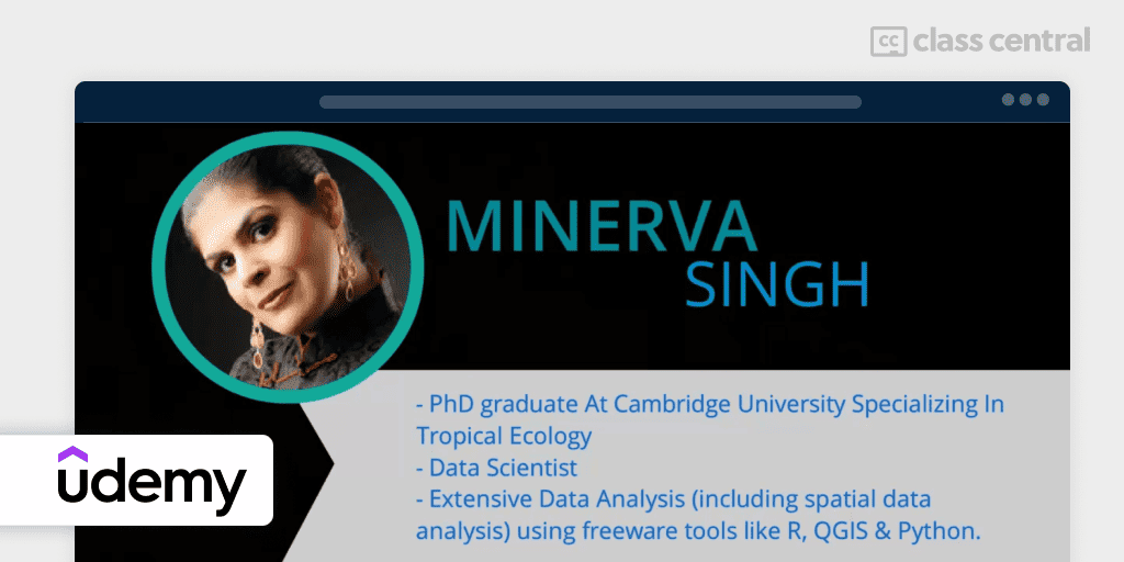
If you are someone who uses R and QGIS for basic spatial data analysis and wants to perform more advanced GIS tasks, then [Intermediate] Spatial Data Analysis with R, QGIS & More is for you. Other than R and QGIS, you’ll also be introduced to another free GIS software – GRASS. In this hands-on course, you will learn how to apply these free tools to perform spatial analysis.
Note that some of the code provided might be outdated as pointed out by some learners.
Taught by Minerva Singh, a data scientist PhD holder proficient in machine learning, data visualization, spatial data analysis, deep learning and natural language processing tasks using both R and Python.
In this course, you’ll:
- Perform common spatial data analysis and GIS tasks using free software tools
- Advanced spatial data analysis and mapping using R and QGIS
- Develop robust map-making skills using Google Earth
- Learn to use GRASS GIS for spatial data analysis tasks.
| Provider | Udemy |
| Instructor | Minerva Singh |
| Level | Intermediate |
| Workload | 4-5 hours |
| Enrollments | 6K |
| Rating | 4.4/5.0 (560) |
| Certificate | Paid |
Best GIS Course for Journalists (Knight Center)
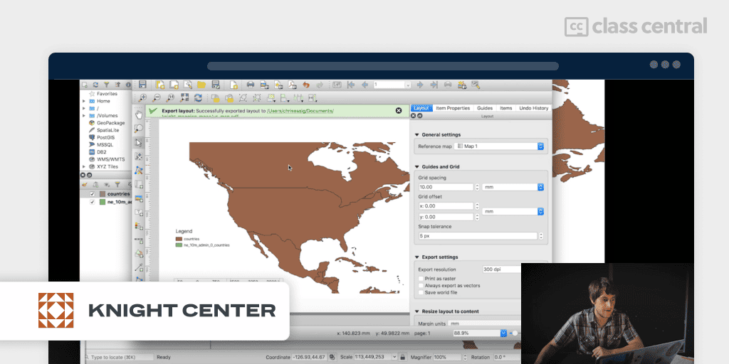
Intro to Mapping and GIS for Journalists is specifically designed for journalists who want to tell stories with geographic data. You’ll learn geographic concepts and best practices through a journalist’s eyes as well as explore tips and tricks, and dive into practical skills to take your geographic data analysis skills to the next level.
Taught by Darla Cameron, a senior data visuals developer at the Texas Tribune, a non-profit news organization, and Chris Essig, a data visuals developer at Texas Tribune, where he builds data visualizations and news apps, you will learn:
- Cartographic basics (latitude and longitude, projections and scale)
- The different types of geographic data (vector points, lines and shapes and raster images)
- How to open and manipulate spatial data in QGIS
- How to geocode data and make a dot map
- Join datasets and edit data in QGIS
- Racial data analysis study case
- Export a map, get it ready for publication, and get to know the publication tools used by journalists.
| Institution/Provider | Knight Center for Journalism in the Americas |
| Instructor | Darla Cameron, Chris Essig |
| Level | Beginner |
| Certificate | Free |
Project-Based: Openlayers 6 Course (Udemy)
As a beginner, Openlayers 6 From Scratch With A Project will introduce you to OpenLayers, open-source JavaScript-based web mapping library. You’ll start with the basics and move up to more advanced concepts of web mapping using the latest version of OpenLayers 6.
Taught by Ikrom Nishanbaev, a programmer and researcher in geospatial technologies, you will learn:
- The basics and key concepts of OpenLayers, raster layers, vector layers, and interact with vector layer features
- Style vector layers, apply overlays, manage multi-layers, and explore projections and coordinate reference systems
- Map interactions, map controls, geolocation API, geospatial formats and standards, and build a complete OpenLayers project.
| Provider | Udemy |
| Instructor | Ikrom Nishanbaev |
| Level | Beginner |
| Workload | 12 hours |
| Enrollments | 3K |
| Rating | 4.5/5.0 (802) |
| Certificate | Paid |
Why You Should Trust Us
Class Central, a Tripadvisor for online education, has helped 60 million learners find their next course. We’ve been combing through online education for more than a decade to aggregate a catalog of 200,000 online courses and 200,000 reviews written by our users. And we’re online learners ourselves: combined, the Class Central team has completed over 400 online courses, including online degrees.
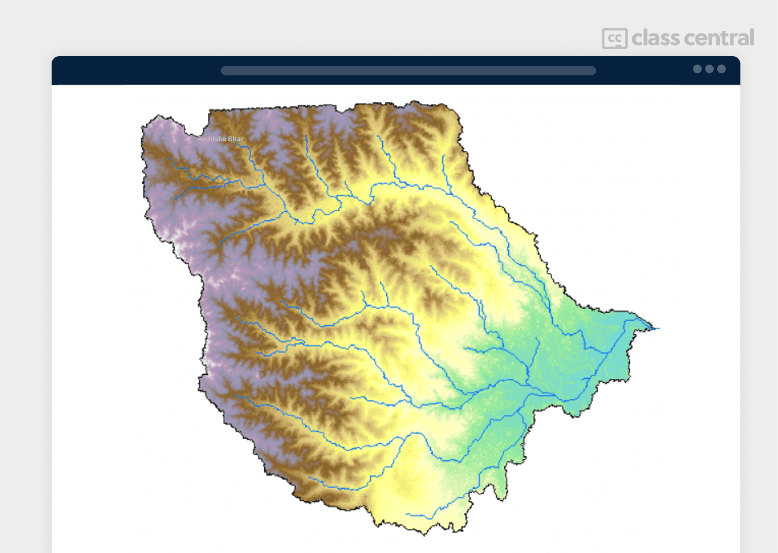
For our final year project, my team and I (Archisha) worked on the floodplain mapping of Ghatal, West Medinipur, a region in the state of West Bengal, India, using HEC-RAS. There, we used ArcGIS to delineate the watershed of Silabati, the main river of Ghatal, and to outline its different characteristics.
I am also a Guided Project Instructor and a Beta Tester at Coursera, having tested many courses before they’re officially launched. I have taken over 50 online courses in various subjects. My experience as an online learner and teacher has given me some perspective on what to look for in an online course. I used my experience to evaluate each course in this list.
How We Made Our Picks and Tested Them
Trying to find “the best” can be daunting, even for those of us who live and breathe online courses. Here’s how we approached this task.
First, we combed through Class Central’s Catalog and the internet to find a variety of free and paid courses.
Second, when choosing courses, we considered the following factors:
- Instructor experience: we looked for certified instructors with extensive experience in GIS .
- Course content: we looked for courses that covered a wide range of topics, from the basics to more advanced techniques.
- Student reviews: we read student reviews (when available) to get a sense of the quality of each course.
To evaluate each course, we watched some of the course videos and read the course syllabus. We also looked at the course’s rating and reviews on Class Central and course provider sites.
Ultimately, we used a combination of data and our own judgment to make these picks. We’re confident these recommendations will provide you with the knowledge to work with maps and use GIS tools more efficiently.
Fabio has revised the research and the latest version of this article.

Archisha Bhar


Erik
Thanks for this guide! I’m a newly graduated physicist planning on learning GIS to be able to apply for more jobs in areas I’m interested in; this was very helpful!