Course review: Going Places with Spatial Analysis
Learn spatial analysis from scratch with a flexible schedule, interactive online software, experienced tutors, readings and a lively community of learners.
The course is called Going Places with Spatial Analysis by Esri. Spatial analysis is one world inside our own. The course uses an interactive software: Arcgis Online which is the studio used to practice as you go. The course takes you through spatial analysis from zero. You learn from experienced tutors, readings and an online community. I enrolled in May 2022. It took six weeks with a very flexible lesson plan which meant I did whatever I wanted with it. I can tell you more because I learnt so much.
My motivation to do it
What made me search for this course was the problems of climate change, ecological monitoring and surveillance. I had done work with elevation data, contour maps, hill shade maps and choropleth maps but I had elementary ideas on inside-our-planet dynamics.
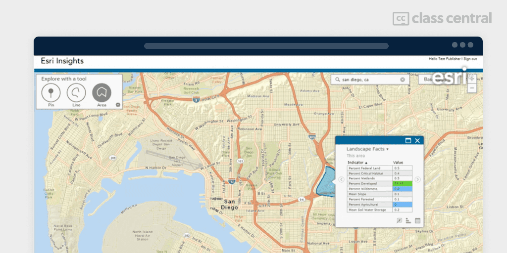
You might think it wouldn’t get neater and more efficient but Arcgis online is to me the best application to fondle and get beautiful maps if you know what to do.
My Goals
My short term goal is to hone my skills on the software, familiarize myself and achieve a zen like flow state with it. My long term goal is to one day be part of the people doing wonderful work with this software.
Tutors

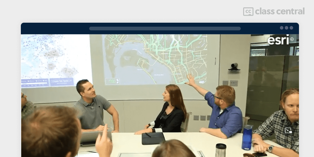
I enjoyed listening to the course instructors and I feel like they know what they are doing. They were direct as though they said only the right words to get you to understand. I had to watch the lectures several times and take notes. I loved reading essays and doing exercises. Oh, what did I miss? The quizzes too. I had a fun time tinkering between the options.
Prerequisites
No special class is necessary. I have a Bachelor’s degree in Environmental Management. Yet I do think, I did not need it to know what was going on.
You need two things: Interest and time to study and practice. I think that having these will enable your fluid migration from section to lesson to discussion. At discussion you get to share your thoughts, what you learnt and other things you want others to know.
The Course
There are six sections to cover:
Section 1-Geography Matters
Section one introduces spatial analysis and all the various ways that location affects our lives.
It identifies the tools and data used to explore spatial questions and problems.
Section 2-Understanding and Comparing Places
Spatially all things are related. Different locations have different physical and cultural elements and populations. Locations can be described and summarized with attributes and can be compared to one another.
Section 3-Determining How Places are Related
How you organize your data affects your understanding of locations. Choosing the appropriate scale and combining meaningful data sets can help uncover divergence or similarities. Data overlay either intersection or union can be quite insightful. It is exciting that familiar features could be seen in a new way.
Section 4-Finding the Best Locations and Paths
Section four is where you ask the data questions related to topology. Topology
defines spatial relationships between features. Querying these relationships along with specific attributes helps find optimal locations for activities, structures and routes.
Section 5-Detecting and Quantifying Patterns
Information on the distribution patterns of a phenomenon can guide policies that encourage positive activities and deter negative ones (see outline).
Section 6-Making Predictions
Models aid predict the characteristics of features. In situations where data is not available, models help analysts understand the causes of spatial patterns. Models can be dumb as they lack ability to simulate complexity. “All models are wrong but some are useful”, said George Box. I learnt about two models: the boolean suitability model and the cost path analysis model.
More on Course Payload
In the onset: visualization. Spatial analysis is a map production tool-set. Whatever the application, such as elevation, outbreak of diseases, flood zone mapping, population mapping, a curious query, or think-visualization, how can you make it visual and study it?
Geographic features and processes are presented and studied using vector or raster data sets. In the lesson about the MAUP (Modifiable Area Unit Problem), you will get to see qualms about presenting the same data but across varying areas.
Points, lines and polygons are vector data sets that you can point out on maps. When observing the distribution of datasets you can notice that distribution characteristics depend on the area of interest. In a small area of interest you will find that some neighborhoods may seem like a city. Let us say, village capital. Over an extended area of interest, the housing units, road lengths and public/commercial buildings become few and then you see a village and not the city you expected. This is the MAUP.
Area features are visualized using density mapping like kernel density map and classification.
In the first section, I learnt quite much. We were taught the concept of spatial dependence, about cluster analysis, hot spot analysis and predictions. Using spatial analysis you can build models such as the gravity model also called the huff model. There is the regression analysis. Using spatial interpolation unknown spatial values can be deduced from known data values.
There is the section on Query, overlay analysis and suitability analysis. However, do not mix up the cartography lessons and exercises. Map projections are very significant to spatial analysts. They determine accuracy of analysis performed by the analyst. With the capabilities of geospatial analysis you can analyze business data (sales, advertising), health data (disease spread, patient proximity) or environmental data (temperature, snowfall). Esri gives free access to Arcgis Online to practice lessons as you progress at each stage and it can be navigated with ease and comfort online.
Discussions
Discussions were held on the forum. It is amusing how the same thing can be looked at differently. There is freedom of expression and very constructive and creative class members were there. It helped me to read more comments sometimes before I post and sometimes after I posted mine I read others. Tutors are part of the forum too. It is very effective for reflection and personal/peer evaluation. You cannot afford to snob. Being part of the conversation was the handle for me. I went through the lesson videos and posted my opinions.
Quizzes and Grading
I admire the quiz grading. I got 5 out of 5 in some but selected the wrong answers in some others, however, I could learn from the feedback. You can retake the test multiple times and It served as a review session for me.
Twice I had to refer back to my notes to be sure. The intelligence quizzes tests you and teaches you. It was a double bubble. Even when your answer is right, you can learn a thing or two. I think the classes are easy and I believe it was because of the superb material and community they have put together. The certificate is ready upon completion of all the material and quizzes.
Time Required
I had no difficulty logging in as I wanted, but the sections were not accessible at the same time. The schedule will get you to the four weeks of material as you move along the course. I used my free time off work to log in and to meet a deadline, I had to clear my schedule one day and I was amazed how much I covered in an hour.
It took me four hours working on the exercises and notes. I would say my personal schedule each week wasn’t even. I did about two hours for the first week. I had online time and offline time as well. Online was two hours per week. And offline had me for some two hours on the average.
My Expectation
I got exactly as the course promised and It even surpassed my expectations. The contents were very objective, friendly and exacting. I became comfortable as the lessons progressed and I think the user interface understood me and what I was doing there.